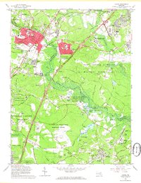
1965 Map of Laurel
USGS Topo · Published 1966About this map
Laurel and the surrounding Maryland corridor appear here as a landscape of rapid mid-century institutional and suburban growth. The National Security Agency occupies a prominent footprint near the Argonne Hills, adjacent to the expansive Fort George G Meade Military Reservation. This era is defined by the intersection of military, federal research, and local community life, with the Goddard Space Flight Center (NASA) and the U S Dept of Agriculture Research Center sharing the map with historic sites like Snow Hill Manor and Perkins Chapel. Transport networks including the Baltimore and Ohio RR and the Baltimore and Washington Parkway stitch together the towns of Maryland City, Contee, and Bowie. The Patuxent River and its varied marshes, including the Island Marshes and Knowles Marshes, provide a natural buffer between these developing federal enclaves and burgeoning residential neighborhoods.
Find a feature on this map
104 named features on this map. Tap any name to fly to it.
Don’t see what you’re looking for? This feature index may not catch every label — zoom into the map to look around manually.
Map Details
Editions of this 1965 Laurel Map
4 editions found
Other maps of this area

1892 · Laurel
USGS Topo · 1:62,500

1892 · Owensville
USGS Topo · 1:62,500

1894 · Laurel
USGS Topo · 1:62,500

1894 · Relay
USGS Topo · 1:62,500

1895 · Owensville
USGS Topo · 1:62,500

1897 · Laurel
USGS Topo · 1:62,500

1899 · Patuxent
USGS Topo · 1:125,000

1900 · Washington
USGS Topo · 1:62,500

1905 · Owensville
USGS Topo · 1:62,500

1906 · Patuxent
USGS Topo · 1:125,000