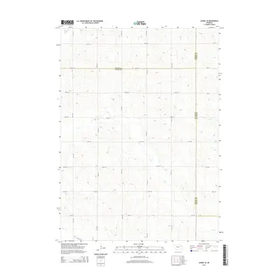
2014 Map of Laurel SE
USGS Topo · Published 2014About this map
The rolling agricultural uplands where Cedar, Wayne, and Dixon counties meet are defined by a strict section-line road grid and the drainage of several prairie creeks. In the early 21st century, this landscape remains primarily rural, with the terrain carved by the meandering courses of Dog Creek, Baker Creek, and Dry Creek. The map documents the precise intersection of these county jurisdictions, showing how local infrastructure like 865th Road and 577th Avenue navigates the undulating topography. This survey provides a clear view of the rural settlement patterns in northeast Nebraska, where the land is divided into systematic agricultural blocks between the seasonal waterways of Deer Creek and its tributaries.
Find a feature on this map
20 named features on this map. Tap any name to fly to it.
Don’t see what you’re looking for? This feature index may not catch every label — zoom into the map to look around manually.
Map Details
Editions of this 2014 Laurel SE Map
This is the sole edition of this map. No revisions or reprints were ever made.
Other maps of this area

1955 · Sioux City
USGS Topo · 1:250,000

1958 · Sioux City
USGS Topo · 1:250,000

1959 · Sioux City
USGS Topo · 1:250,000

1963 · Winside
USGS Topo · 1:24,000

1963 · Wayne
USGS Topo · 1:24,000

1966 · Altona NW
USGS Topo · 1:24,000

1967 · Wakefield SW
USGS Topo · 1:24,000
1967 · Concord
USGS Topo · 1:24,000
1971 · Laurel
USGS Topo · 1:24,000

1971 · Belden
USGS Topo · 1:24,000