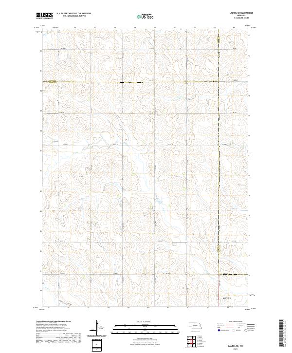
2021 Map of Laurel SE
USGS Topo · Published 2021About this map
Wayne county and the surrounding agricultural landscapes of Cedar Co and Dixon Co are defined by a methodical grid of section lines and rural corridors in this 2021 study. The terrain is deeply inscribed by several drainages, including the prominent Dog Cr and Dry Cr, which carve through the undulating plains. The map illustrates the convergence of three Nebraska counties, with the Wayne Co Dixon Co and Cedar Co Wayne Co borders meeting along critical transport routes like 864th Rd. While largely agricultural, the network of local roads such as 576th Ave and 571st Ave reveals the persistent organization of the Public Land Survey System, which continues to dictate the placement of farmsteads and property boundaries across this section of northeast Nebraska.
Find a feature on this map
71 named features on this map. Tap any name to fly to it.
Don’t see what you’re looking for? This feature index may not catch every label — zoom into the map to look around manually.
Map Details
Editions of this 2021 Laurel SE Map
This is the sole edition of this map. No revisions or reprints were ever made.
Other maps of this area

1955 · Sioux City
USGS Topo · 1:250,000

1958 · Sioux City
USGS Topo · 1:250,000

1959 · Sioux City
USGS Topo · 1:250,000

1963 · Winside
USGS Topo · 1:24,000

1963 · Wayne
USGS Topo · 1:24,000

1966 · Altona NW
USGS Topo · 1:24,000

1967 · Wakefield SW
USGS Topo · 1:24,000
1967 · Concord
USGS Topo · 1:24,000
1971 · Laurel
USGS Topo · 1:24,000

1971 · Belden
USGS Topo · 1:24,000