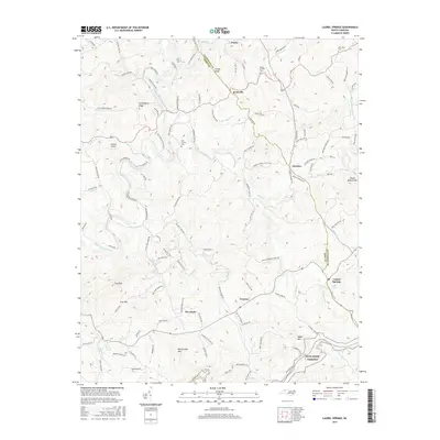
2016 Map of Laurel Springs
USGS Topo · Published 2016About this map
The South Fork New River meanders through the northwest corner of this highland region on the border of Ashe and Alleghany counties, providing a focal point for the surrounding topography. The landscape is defined by significant elevations such as The Peak and Peach Bottom Mtn, with the historic Blue Ridge Parkway traversing the southeastern corner. This area is dotted with small settlements like Scottville, Furches, and Laurel Springs, which are connected by a network of winding mountain roads and family-named landmarks.
Find a feature on this map
119 named features on this map. Tap any name to fly to it.
Don’t see what you’re looking for? This feature index may not catch every label — zoom into the map to look around manually.
Map Details
Editions of this 2016 Laurel Springs Map
This is the sole edition of this map. No revisions or reprints were ever made.
Other maps of this area

1889 · Wytheville
USGS Topo · 1:125,000

1889 · Wilkesboro
USGS Topo · 1:125,000

1891 · Wilkesboro
USGS Topo · 1:125,000

1892 · Wytheville
USGS Topo · 1:125,000

1930 · Independence
USGS Topo · 1:48,000

1933 · Independence
USGS Topo · 1:62,500

1935 · Mouth of Wilson
USGS Topo · 1:48,000

1940 · Mouth of Wilson
USGS Topo · 1:62,500

1953 · Winston-Salem
USGS Topo · 1:250,000

1955 · Winston-Salem
USGS Topo · 1:250,000