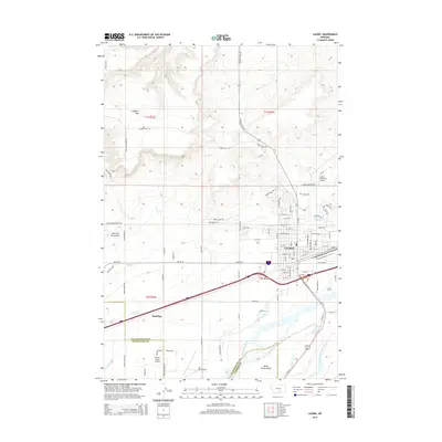
2014 Map of Laurel
USGS Topo · Published 2014About this map
The city of Laurel serves as a central hub in this Montana landscape, where the Yellowstone River and the Clarks Fork Yellowstone River converge. This 2014 survey documents a complex irrigation network vital to the region's agricultural character, featuring the Big Ditch, Clarks Fork Ditch, and Mason Canal. These waterways snake across the terrain below White Horse Bench and Clappers Flat, illustrating how water management has historically defined land use in Yellowstone County.
Find a feature on this map
96 named features on this map. Tap any name to fly to it.
Don’t see what you’re looking for? This feature index may not catch every label — zoom into the map to look around manually.
Map Details
Editions of this 2014 Laurel Map
This is the sole edition of this map. No revisions or reprints were ever made.
Other maps of this area

1954 · Billings
USGS Topo · 1:250,000

1956 · Molt
USGS Topo · 1:24,000

1956 · Rimrock
USGS Topo · 1:24,000

1956 · Silesia
USGS Topo · 1:24,000

1956 · Two Pine School
USGS Topo · 1:24,000

1956 · Laurel
USGS Topo · 1:24,000

1956 · Park City
USGS Topo · 1:24,000
1956 · Montaqua
USGS Topo · 1:24,000

1956 · Mossmain
USGS Topo · 1:24,000

1957 · Billings
USGS Topo · 1:250,000