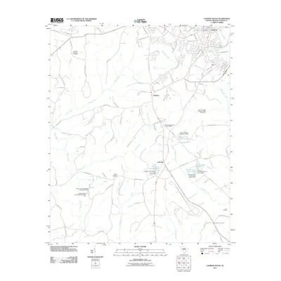
2011 Map of Laurens South
USGS Topo · Published 2011About this map
Laurens sits at the northern edge of this Piedmont landscape, serving as a focal point for the surrounding rural communities. The area is defined by a series of small settlements and local crossroads, including Irby, Maddens, and Cold Point. These locales are connected by a network of residential and farm-to-market roads such as Stagecoach Rd and Indian Mound Rd, reflecting the historical transition of the land from large agrarian holdings to smaller parcels and residential developments near the county seat.
Find a feature on this map
105 named features on this map. Tap any name to fly to it.
Don’t see what you’re looking for? This feature index may not catch every label — zoom into the map to look around manually.
Map Details
Editions of this 2011 Laurens South Map
This is the sole edition of this map. No revisions or reprints were ever made.
Other maps of this area

1892 · Abbeville
USGS Topo · 1:125,000

1941 · Spartanburg
USGS Topo · 1:250,000

1953 · Spartanburg
USGS Topo · 1:250,000

1954 · Greenville
USGS Topo · 1:250,000

1957 · Fountain Inn
USGS Topo · 1:62,500

1958 · Greenville
USGS Topo · 1:250,000

1960 · Spartanburg
USGS Topo · 1:250,000

1963 · Spartanburg
USGS Topo · 1:250,000

1964 · Spartanburg
USGS Topo · 1:250,000

1969 · Ora
USGS Topo · 1:24,000