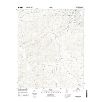
2014 Map of Laurens South
USGS Topo · Published 2014About this map
Laurens anchor this landscape, where the town's southern outskirts give way to a network of creeks and rural family properties. The area is defined by the drainage systems of the Little River and Rabon Cr, with numerous smaller waterways like Burnt Mill Cr and Burris Cr carving through the countryside. This 2014 survey reveals a transition from the urban streets of the county seat to unincorporated communities like Maddens, Irby, and Cold Point. Genealogists and local historians will find significant value in the documentation of several family and community landmarks, including Jersey Cem, Mt Pleasant Cem, and Lisbon Cem. The inclusion of a named Indian Mound near the banks of Rabon Cr points to a much deeper history of human habitation in the region, while modern names like Larry Crenshaw Pond and Virginia Coleman Pond reflect more recent land ownership and agricultural use.
Find a feature on this map
137 named features on this map. Tap any name to fly to it.
Don’t see what you’re looking for? This feature index may not catch every label — zoom into the map to look around manually.
Map Details
Editions of this 2014 Laurens South Map
This is the sole edition of this map. No revisions or reprints were ever made.
Other maps of this area

1892 · Abbeville
USGS Topo · 1:125,000

1941 · Spartanburg
USGS Topo · 1:250,000

1953 · Spartanburg
USGS Topo · 1:250,000

1954 · Greenville
USGS Topo · 1:250,000

1957 · Fountain Inn
USGS Topo · 1:62,500

1958 · Greenville
USGS Topo · 1:250,000

1960 · Spartanburg
USGS Topo · 1:250,000

1963 · Spartanburg
USGS Topo · 1:250,000

1964 · Spartanburg
USGS Topo · 1:250,000

1969 · Ora
USGS Topo · 1:24,000