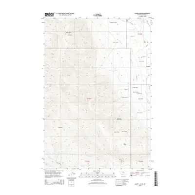
2014 Map of Laurin Canyon
USGS Topo · Published 2014About this map
The Ruby River meanders through the northeastern corner of this Montana landscape, supporting the small settlement area known as The Island and the broader Ruby Valley. The terrain is defined by the eastern slopes of the Ruby Range, where numerous drainages have carved a complex series of canyons. Significant topographical features include Laurin Canyon, Taylor Canyon, and Bouge Canyon, which descend toward the river valley.
Find a feature on this map
48 named features on this map. Tap any name to fly to it.
Don’t see what you’re looking for? This feature index may not catch every label — zoom into the map to look around manually.
Map Details
Editions of this 2014 Laurin Canyon Map
This is the sole edition of this map. No revisions or reprints were ever made.
Other maps of this area

1893 · Dillon
USGS Topo · 1:250,000

1955 · Dillon
USGS Topo · 1:250,000

1957 · Dillon
USGS Topo · 1:250,000

1958 · Dillon
USGS Topo · 1:250,000

1961 · Mine Gulch
USGS Topo · 1:24,000

1961 · Beaverhead Rock SE
USGS Topo · 1:24,000

1962 · Dillon
USGS Topo · 1:250,000
1962 · Beaverhead Rock NE
USGS Topo · 1:24,000
1963 · Sheridan
USGS Topo · 1:24,000
1963 · Metzel Ranch
USGS Topo · 1:24,000