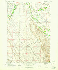
1962 Map of Beaverhead Rock NE
USGS Topo · Published 1964About this map
The Beaverhead River and Ruby River converge in this Madison County landscape, defining an era of intensive water management and agricultural engineering. In 1962, the region was undergoing a significant transformation as the East Bench Canal (Under Construction) was being carved across the benchlands to expand irrigation. This massive project, accompanied by an Aqueduct, reflects the post-war push to stabilize ranching and farming in southwest Montana.
Find a feature on this map
27 named features on this map. Tap any name to fly to it.
Don’t see what you’re looking for? This feature index may not catch every label — zoom into the map to look around manually.
Map Details
Editions of this 1962 Beaverhead Rock NE Map
This is the sole edition of this map. No revisions or reprints were ever made.
Other maps of this area

1893 · Dillon
USGS Topo · 1:250,000

1955 · Dillon
USGS Topo · 1:250,000

1957 · Dillon
USGS Topo · 1:250,000

1958 · Dillon
USGS Topo · 1:250,000

1960 · Twin Bridges
USGS Topo · 1:62,500

1960 · Waterloo
USGS Topo · 1:62,500

1961 · Beaverhead Rock SE
USGS Topo · 1:24,000

1962 · Dillon
USGS Topo · 1:250,000
1962 · Beaverhead Rock
USGS Topo · 1:24,000
1962 · Beaverhead Rock SW
USGS Topo · 1:24,000