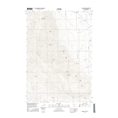
2017 Map of Laurin Canyon
USGS Topo · Published 2017About this map
The Ruby Valley and the Ruby Range converge in this high-altitude landscape where water management defines the boundary between the mountains and the valley floor. The drainage of California Cr and Clear Cr feeds into a complex system of human-engineered irrigation, including the Passamari Ditch, Ayotte Ditch, and W Bench Canal. These features illustrate the vital role of water rights and ranching infrastructure in Madison County's development.
Find a feature on this map
47 named features on this map. Tap any name to fly to it.
Don’t see what you’re looking for? This feature index may not catch every label — zoom into the map to look around manually.
Map Details
Editions of this 2017 Laurin Canyon Map
This is the sole edition of this map. No revisions or reprints were ever made.
Other maps of this area

1893 · Dillon
USGS Topo · 1:250,000

1955 · Dillon
USGS Topo · 1:250,000

1957 · Dillon
USGS Topo · 1:250,000

1958 · Dillon
USGS Topo · 1:250,000

1961 · Mine Gulch
USGS Topo · 1:24,000

1961 · Beaverhead Rock SE
USGS Topo · 1:24,000

1962 · Dillon
USGS Topo · 1:250,000
1962 · Beaverhead Rock NE
USGS Topo · 1:24,000
1963 · Sheridan
USGS Topo · 1:24,000
1963 · Metzel Ranch
USGS Topo · 1:24,000