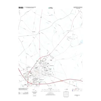
2013 Map of Laurinburg
USGS Topo · Published 2013About this map
East Laurinburg and the surrounding Scotland County landscape are defined by a dense network of residential subdivisions and historical watercourses. The map reveals the expansion of the area through named developments such as Lincoln Heights, McLaurin Acres, and Westland Forest, which encircle the established core. Agricultural and industrial heritage is visible through features like Gibson Mill in the north and the expansive McBryde Farm. The geography is intricately tied to the local hydrology, with Jordan Creek and Leith Creek cutting through the terrain. Evidence of earlier rural life persists in the placement of Lees Mill Pond and McNair Pond, while the proximity of Sugar Hill and Glen Acres reflects the mid-century suburban growth patterns typical of this North Carolina region. The presence of Railroad Street underscores the historical importance of the rail line to the local economy and urban layout.
Find a feature on this map
185 named features on this map. Tap any name to fly to it.
Don’t see what you’re looking for? This feature index may not catch every label — zoom into the map to look around manually.
Map Details
Editions of this 2013 Laurinburg Map
This is the sole edition of this map. No revisions or reprints were ever made.
Other maps of this area

1942 · Rockingham
USGS Topo · 1:125,000

1949 · Gibson
USGS Topo · 1:24,000

1949 · Wagram
USGS Topo · 1:24,000

1949 · Laurinburg
USGS Topo · 1:24,000

1949 · Silver Hill
USGS Topo · 1:24,000

1949 · Marston
USGS Topo · 1:24,000

1949 · Wakulla
USGS Topo · 1:24,000

1949 · Hamlet
USGS Topo · 1:62,500

1949 · Laurinburg
USGS Topo · 1:62,500

1953 · Florence
USGS Topo · 1:250,000
Featured Places
- Laurinburg, NC
- East Laurinburg, NC
- Langley Place Mobile Home Park, NC
- McBryde Farm, NC
- Norman Heights, Laurinburg