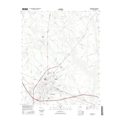
2016 Map of Laurinburg
USGS Topo · Published 2016About this map
Laurinburg serves as the focal point of this coastal plain landscape, surrounded by a ring of residential and community developments including East Laurinburg, North View, and Lincoln Heights. The town's layout is defined by its historic core and newer expansions like Middleton Heights and Sugar Hill, while the outlying areas maintain a rural character punctuated by family-named landmarks and cemeteries. Numerous burial grounds such as Hillside Cem, Stewart Cem, and Pate Cem are scattered throughout the countryside, offering vital clues for genealogical research. The hydrology of the region is shaped by several water bodies, most notably Leith Cr, Jordan Cr, and Little Juniper Cr, which thread through the flat terrain alongside historical processing sites like Gibson Mill. The presence of Scotland High School and several ponds, including Lees Mill Pond and McNair Pond, reflect the community's established infrastructure and agricultural heritage.
Find a feature on this map
139 named features on this map. Tap any name to fly to it.
Don’t see what you’re looking for? This feature index may not catch every label — zoom into the map to look around manually.
Map Details
Editions of this 2016 Laurinburg Map
This is the sole edition of this map. No revisions or reprints were ever made.
Other maps of this area

1942 · Rockingham
USGS Topo · 1:125,000

1949 · Gibson
USGS Topo · 1:24,000

1949 · Wagram
USGS Topo · 1:24,000

1949 · Laurinburg
USGS Topo · 1:24,000

1949 · Silver Hill
USGS Topo · 1:24,000

1949 · Marston
USGS Topo · 1:24,000

1949 · Wakulla
USGS Topo · 1:24,000

1949 · Hamlet
USGS Topo · 1:62,500

1949 · Laurinburg
USGS Topo · 1:62,500

1953 · Florence
USGS Topo · 1:250,000
Featured Places
- Laurinburg, NC
- East Laurinburg, NC
- Langley Place Mobile Home Park, NC
- McBryde Farm, NC
- Norman Heights, Laurinburg