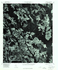
1976 Map of Laurinburg
USGS Topo · Published 1978About this map
Laurinburg and its surrounding agricultural landscape appear in sharp detail through this orthophotoquad, created from aerial imagery captured in early 1976. The grid of the city center transitions into the industrial and residential clusters of East Laurinburg and Sugar Hill, revealing the footprint of the mid-1970s Piedmont region before significant modern expansion. The image clearly defines the relationship between the built environment and the local hydrology, featuring bodies of water such as Mc Nair Pond and the area identified as Jordan. Unlike a traditional topographic map, this photographic record provides a direct look at field patterns, forest boundaries, and the density of local neighborhoods during a period of steady growth in Scotland County.
Find a feature on this map
5 named features on this map. Tap any name to fly to it.
Don’t see what you’re looking for? This feature index may not catch every label — zoom into the map to look around manually.
Map Details
Editions of this 1976 Laurinburg Map
This is the sole edition of this map. No revisions or reprints were ever made.
Other maps of this area

1942 · Rockingham
USGS Topo · 1:125,000

1949 · Gibson
USGS Topo · 1:24,000

1949 · Wagram
USGS Topo · 1:24,000

1949 · Laurinburg
USGS Topo · 1:24,000

1949 · Silver Hill
USGS Topo · 1:24,000

1949 · Marston
USGS Topo · 1:24,000

1949 · Wakulla
USGS Topo · 1:24,000

1949 · Hamlet
USGS Topo · 1:62,500

1949 · Laurinburg
USGS Topo · 1:62,500

1953 · Florence
USGS Topo · 1:250,000