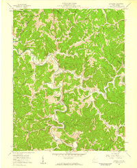
1957 Map of Lavalette
USGS Topo · Published 1959About this map
Twelvepole Creek snakes through the center of this 1950s Wayne County landscape, dictating the placement of the Norfolk and Western railway and the small riverside communities of Lavalette and Dickson. The map reveals a deeply etched topography of winding hollows and ridges, where life centered around local institutions like Florence Memorial Ch and the Big Creek Sch. To the northeast, the Guyandotte River cuts across the corner of the quadrangle near Hodges, while the southern reaches show scattered rural settlements like Herbert and Booton.
Find a feature on this map
50 named features on this map. Tap any name to fly to it.
Don’t see what you’re looking for? This feature index may not catch every label — zoom into the map to look around manually.
Map Details
Editions of this 1957 Lavalette Map
2 editions found
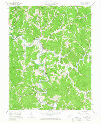
Other maps of this area

1892 · Huntington
USGS Topo · 1:125,000

1898 · Huntington
USGS Topo · 1:125,000

1901 · Guyandot
USGS Topo · 1:62,500

1901 · Ceredo
USGS Topo · 1:62,500

1902 · Guyandot
USGS Topo · 1:62,500

1903 · Kenova
USGS Topo · 1:125,000

1904 · Kenova
USGS Topo · 1:125,000

1909 · Wayne
USGS Topo · 1:62,500

1911 · Louisa
USGS Topo · 1:48,000

1913 · Ceredo
USGS Topo · 1:62,500