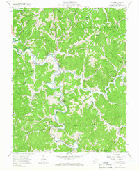
1957 Map of Lavalette
USGS Topo · Published 1966About this map
The winding loops of Twelvepole Creek define the landscape south of Huntington in the late 1950s, a region where community life centered on rural schools and numerous small houses of worship. Small settlements such as Lavalette, Shoals, and Dickson follow the valley floors, while the Norfolk and Western railroad tracks trace the water's edge. This era shows a well-established network of upland churches, including Florence Memorial Ch, Newcomb Missionary Ch, and Lynn Chapel, serving family clusters near local schools like Big Creek Sch and Mt Union Sch. Beyond the residential areas, the terrain is cut by deep drainages like Beech Fork and Guyandotte River, with specific natural landmarks like Dickson Falls and Walnut Gap punctuating the ridges. The map provides a detailed view of the social geography of Wayne County before later infrastructure changes, recording names like Newcomb Cem and Smith Cem that anchor local family histories.
Find a feature on this map
50 named features on this map. Tap any name to fly to it.
Don’t see what you’re looking for? This feature index may not catch every label — zoom into the map to look around manually.
Map Details
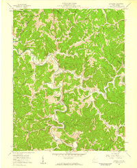
Editions of this 1957 Lavalette Map
2 editions found
Other maps of this area

1892 · Huntington
USGS Topo · 1:125,000

1898 · Huntington
USGS Topo · 1:125,000

1901 · Guyandot
USGS Topo · 1:62,500

1901 · Ceredo
USGS Topo · 1:62,500

1902 · Guyandot
USGS Topo · 1:62,500

1903 · Kenova
USGS Topo · 1:125,000

1904 · Kenova
USGS Topo · 1:125,000

1909 · Wayne
USGS Topo · 1:62,500

1911 · Louisa
USGS Topo · 1:48,000

1913 · Ceredo
USGS Topo · 1:62,500