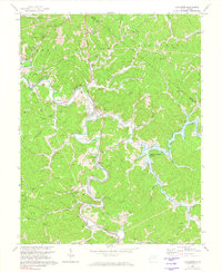
1972 Map of Lavalette
USGS Topo · Published 1974About this map
Lavalette and its surrounding river valleys are captured here in the early 1970s, a period defined by significant hydrological transition. The most striking visual element is the blue hatching indicating the future inundation of Beech Fork Lake, an area slated for controlled flooding up to 615 feet. This planned expansion of the reservoir system drastically altered the landscape around Beech Fork and its tributaries like Miller Branch.
Find a feature on this map
52 named features on this map. Tap any name to fly to it.
Don’t see what you’re looking for? This feature index may not catch every label — zoom into the map to look around manually.
Map Details
Editions of this 1972 Lavalette Map
3 editions found

Other maps of this area

1892 · Huntington
USGS Topo · 1:125,000

1898 · Huntington
USGS Topo · 1:125,000

1901 · Guyandot
USGS Topo · 1:62,500

1901 · Ceredo
USGS Topo · 1:62,500

1902 · Guyandot
USGS Topo · 1:62,500

1903 · Kenova
USGS Topo · 1:125,000

1904 · Kenova
USGS Topo · 1:125,000

1909 · Wayne
USGS Topo · 1:62,500

1911 · Louisa
USGS Topo · 1:48,000

1913 · Ceredo
USGS Topo · 1:62,500