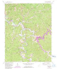
1972 Map of Lavalette
USGS Topo · Published 1989About this map
Twelvepole Creek defines the local geography as it snakes through the hills of Wayne County, creating a valley for settlements like Shoals, Lavalette, and Dickson. By the early 1970s, the landscape was undergoing a significant shift with the creation of the Beech Fork Lake Public Hunting and Fishing Area, which inundated portions of the Beech Fork valley. This transition from a traditional creek-bottom agricultural and residential pattern to a recreational reservoir is a central feature of the map.
Find a feature on this map
47 named features on this map. Tap any name to fly to it.
Don’t see what you’re looking for? This feature index may not catch every label — zoom into the map to look around manually.
Map Details
Editions of this 1972 Lavalette Map
3 editions found

Other maps of this area

1892 · Huntington
USGS Topo · 1:125,000

1898 · Huntington
USGS Topo · 1:125,000

1901 · Guyandot
USGS Topo · 1:62,500

1901 · Ceredo
USGS Topo · 1:62,500

1902 · Guyandot
USGS Topo · 1:62,500

1903 · Kenova
USGS Topo · 1:125,000

1904 · Kenova
USGS Topo · 1:125,000

1909 · Wayne
USGS Topo · 1:62,500

1911 · Louisa
USGS Topo · 1:48,000

1913 · Ceredo
USGS Topo · 1:62,500