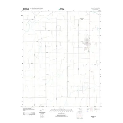
2012 Map of Laverne
USGS Topo · Published 2012About this map
Laverne serves as the central hub of this Harper County landscape, situated where the high plains meet the drainages of the Beaver River and Kiowa Cr. The town's layout reflects a traditional grid punctuated by local history, including Jane Jayroe St, named for the 1967 Miss America and Laverne native. This survey shows the community's infrastructure in the early 21st century, from the Laverne Municipal Airport in the north to the Laverne Memorial Cem on the eastern outskirts. The surrounding rural areas are defined by a strict section-line road system, including N 1700 RD and E 0200 RD, which navigate the terrain around Spring Cr. For genealogists, the map provides precise locations for both the town's memorial grounds and the more remote Highland Cem to the south, essential for tracing family ties in this part of Northwest Oklahoma.
Find a feature on this map
31 named features on this map. Tap any name to fly to it.
Don’t see what you’re looking for? This feature index may not catch every label — zoom into the map to look around manually.
Map Details
Editions of this 2012 Laverne Map
This is the sole edition of this map. No revisions or reprints were ever made.
Other maps of this area

1954 · Perryton
USGS Topo · 1:250,000

1955 · Woodward
USGS Topo · 1:250,000

1958 · Perryton
USGS Topo · 1:250,000

1958 · Woodward
USGS Topo · 1:250,000

1970 · Gate
USGS Topo · 1:24,000

1970 · Laverne SW
USGS Topo · 1:24,000

1971 · Rosston SE
USGS Topo · 1:24,000

1971 · Rosston
USGS Topo · 1:24,000

1971 · Logan NE
USGS Topo · 1:24,000

1971 · Slapout
USGS Topo · 1:24,000