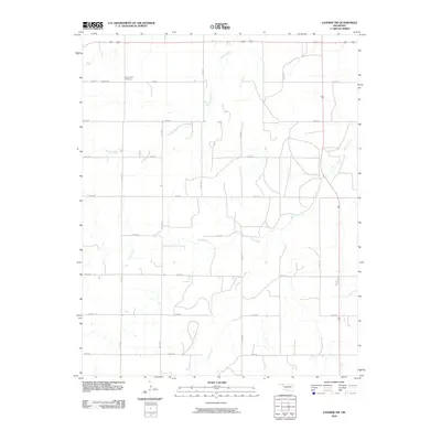
2010 Map of Laverne SW
USGS Topo · Published 2010About this map
Speermoore Cemetery serves as a primary historical landmark in this corner of Harper County, situated near the northern edge of the map. This High Plains landscape is defined by its drainage patterns, most notably the winding paths of Spring Creek, Clear Creek, and Dry Prong. The area is organized around a strict grid of county roads, including east-west routes like e0280 RD and north-south corridors such as n1720 RD. The sparse settlement pattern reflects a modern ranching and agricultural economy, where long-standing family landholdings are connected by a network of well-defined section roads that have persisted through generations of Oklahoma land management.
Find a feature on this map
17 named features on this map. Tap any name to fly to it.
Don’t see what you’re looking for? This feature index may not catch every label — zoom into the map to look around manually.
Map Details
Editions of this 2010 Laverne SW Map
This is the sole edition of this map. No revisions or reprints were ever made.
Other maps of this area

1954 · Perryton
USGS Topo · 1:250,000

1955 · Woodward
USGS Topo · 1:250,000

1958 · Perryton
USGS Topo · 1:250,000

1958 · Woodward
USGS Topo · 1:250,000

1969 · Shattuck NW
USGS Topo · 1:24,000

1969 · Shattuck NE
USGS Topo · 1:24,000

1970 · Laverne SW
USGS Topo · 1:24,000

1971 · Logan NE
USGS Topo · 1:24,000

1971 · Slapout
USGS Topo · 1:24,000
1971 · Laverne
USGS Topo · 1:24,000