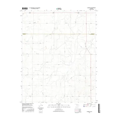
2016 Map of Laverne SW
USGS Topo · Published 2016About this map
Speermoore Cem stands as a quiet focal point in this 2016 survey of the Oklahoma plains, marking a site of local genealogical significance along the northern border of the sheet. The landscape is defined by the gradual descent of the High Plains toward the drainage basins of Spring Cr and Clear Cr. This rural expanse is etched with a precise section-line road grid, including Co Line Rd which traces the boundary between Harper and Ellis Counties. The presence of Oil Fld Rd and numerous unnamed ranch tracks, such as Pasture Rd, points to the dual economic reliance on cattle ranching and energy extraction that characterizes this region. Seasonal watercourses like Dry Prong cut through the terrain, illustrating the hydrologic patterns of the southern plains before they feed into larger river systems.
Find a feature on this map
26 named features on this map. Tap any name to fly to it.
Don’t see what you’re looking for? This feature index may not catch every label — zoom into the map to look around manually.
Map Details
Editions of this 2016 Laverne SW Map
This is the sole edition of this map. No revisions or reprints were ever made.
Other maps of this area

1954 · Perryton
USGS Topo · 1:250,000

1955 · Woodward
USGS Topo · 1:250,000

1958 · Perryton
USGS Topo · 1:250,000

1958 · Woodward
USGS Topo · 1:250,000

1969 · Shattuck NW
USGS Topo · 1:24,000

1969 · Shattuck NE
USGS Topo · 1:24,000

1970 · Laverne SW
USGS Topo · 1:24,000

1971 · Logan NE
USGS Topo · 1:24,000

1971 · Slapout
USGS Topo · 1:24,000
1971 · Laverne
USGS Topo · 1:24,000