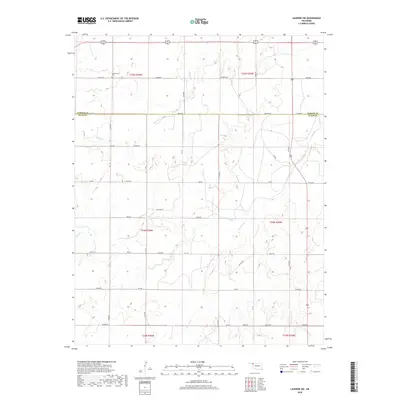
2018 Map of Laverne SW
USGS Topo · Published 2018About this map
Speermoore Cem stands in the northwest corner of this landscape, marking a point of long-standing local heritage near the northern edge of the survey. The terrain is defined by the dendritic patterns of Spring Cr and Clear Cr, which carve through the high plains of the Oklahoma Panhandle region. A grid of section roads, including Co Line Rd and Pasture Rd, organizes the rural space, though the presence of Oil Fld Rd and several closed routes suggests an evolving land use where traditional ranching meets energy extraction. The map illustrates the sparsely populated transition between Harper and Ellis counties, showing a high-plains environment where water sources like Dry Prong dictate the layout of the few established structures and access ways.
Find a feature on this map
31 named features on this map. Tap any name to fly to it.
Don’t see what you’re looking for? This feature index may not catch every label — zoom into the map to look around manually.
Map Details
Editions of this 2018 Laverne SW Map
This is the sole edition of this map. No revisions or reprints were ever made.
Other maps of this area

1954 · Perryton
USGS Topo · 1:250,000

1955 · Woodward
USGS Topo · 1:250,000

1958 · Perryton
USGS Topo · 1:250,000

1958 · Woodward
USGS Topo · 1:250,000

1969 · Shattuck NW
USGS Topo · 1:24,000

1969 · Shattuck NE
USGS Topo · 1:24,000

1970 · Laverne SW
USGS Topo · 1:24,000

1971 · Logan NE
USGS Topo · 1:24,000

1971 · Slapout
USGS Topo · 1:24,000
1971 · Laverne
USGS Topo · 1:24,000