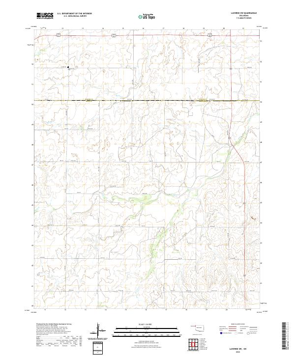
2022 Map of Laverne SW
USGS Topo · Published 2022About this map
Speermoore Cem stands as a quiet focal point in this northwestern Oklahoma landscape, situated just north of the Harper and Ellis County line. The terrain is defined by the dendritic drainage patterns of Spring Cr and Clear Cr, with the latter joined by the seasonal Dry Prong. This area of the High Plains illustrates a structured grid of section-line roads, including E0290 Rd and Co Line Rd, reflecting the enduring legacy of the Public Land Survey System. The presence of Oil Fld Rd and Pasture Rd indicates a landscape primarily dedicated to energy extraction and ranching operations. Navigational details such as the Closed road label near the eastern boundary suggest a shifting local transportation network within these rural townships.
Find a feature on this map
31 named features on this map. Tap any name to fly to it.
Don’t see what you’re looking for? This feature index may not catch every label — zoom into the map to look around manually.
Map Details
Editions of this 2022 Laverne SW Map
This is the sole edition of this map. No revisions or reprints were ever made.
Other maps of this area

1954 · Perryton
USGS Topo · 1:250,000

1955 · Woodward
USGS Topo · 1:250,000

1958 · Perryton
USGS Topo · 1:250,000

1958 · Woodward
USGS Topo · 1:250,000

1969 · Shattuck NW
USGS Topo · 1:24,000

1969 · Shattuck NE
USGS Topo · 1:24,000

1970 · Laverne SW
USGS Topo · 1:24,000

1971 · Logan NE
USGS Topo · 1:24,000

1971 · Slapout
USGS Topo · 1:24,000
1971 · Laverne
USGS Topo · 1:24,000