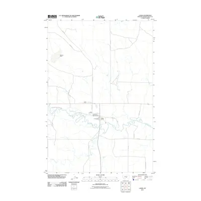
2011 Map of Lavina
USGS Topo · Published 2011About this map
Lavina serves as the focal point of this Golden Valley County landscape, situated along the meandering path of the Musselshell River. The town's layout is defined by a mix of civic services and agricultural infrastructure, including the Lavina Post Office and the Lavina Vol Fire Dept and Emergency Medical Services. A legacy of irrigation is visible through the Lavina Water Users Association Ditch, which draws from the river to support the surrounding benchlands. To the north, the terrain rises toward the distinctive landform known as Womans Pocket, while the southern reaches are marked by the confluence of Big Coulee Creek and Fivemile Creek. Transportation routes like E Red Hill Rd and Cemetery Rd connect the town center to more remote landmarks like the Lavina Cemetery and the Lavina Airport.
Find a feature on this map
24 named features on this map. Tap any name to fly to it.
Don’t see what you’re looking for? This feature index may not catch every label — zoom into the map to look around manually.
Map Details
Editions of this 2011 Lavina Map
This is the sole edition of this map. No revisions or reprints were ever made.
Other maps of this area

1889 · Big Snowy Mountain
USGS Topo · 1:250,000

1893 · Big Snowy Mountain
USGS Topo · 1:250,000

1954 · Roundup
USGS Topo · 1:250,000

1958 · Roundup
USGS Topo · 1:250,000

1979 · Roundup
USGS Topo · 1:100,000

1979 · Bundy
USGS Topo · 1:24,000

1979 · Lavina NW
USGS Topo · 1:24,000

1979 · Timber Buttes South
USGS Topo · 1:24,000

1979 · Lavina
USGS Topo · 1:24,000

1979 · Belmont
USGS Topo · 1:24,000