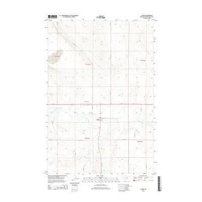
2014 Map of Lavina
USGS Topo · Published 2014About this map
The town of Lavina sits at a strategic junction in Golden Valley County where MT-3 meets Us-12, serving as a central point for the surrounding agricultural plains. The Musselshell River winds through the landscape, its waters diverted into the Lavina Water Users Association Ditch to support the local farming economy. This irrigation system is a defining characteristic of the valley's development, illustrating the long-standing efforts to manage water in this semi-arid region. To the north, the terrain rises toward Womans Pocket, while the southern reaches are marked by the drainage of Big Coulee Cr. Local infrastructure includes the Lavina Airport and the Lavina Cem, which, along with named rural routes like Belmont RD and Three Pines RD, provide a detailed record of the community's footprint in the early 21st century.
Find a feature on this map
27 named features on this map. Tap any name to fly to it.
Don’t see what you’re looking for? This feature index may not catch every label — zoom into the map to look around manually.
Map Details
Editions of this 2014 Lavina Map
This is the sole edition of this map. No revisions or reprints were ever made.
Other maps of this area

1889 · Big Snowy Mountain
USGS Topo · 1:250,000

1893 · Big Snowy Mountain
USGS Topo · 1:250,000

1954 · Roundup
USGS Topo · 1:250,000

1958 · Roundup
USGS Topo · 1:250,000

1979 · Roundup
USGS Topo · 1:100,000

1979 · Bundy
USGS Topo · 1:24,000

1979 · Lavina NW
USGS Topo · 1:24,000

1979 · Timber Buttes South
USGS Topo · 1:24,000

1979 · Lavina
USGS Topo · 1:24,000

1979 · Belmont
USGS Topo · 1:24,000