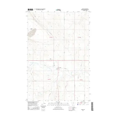
2017 Map of Lavina
USGS Topo · Published 2017About this map
Lavina sits at the heart of this landscape, positioned along the banks of the Musselshell River where local irrigation and transportation history intersect. The map illustrates a community shaped by its proximity to the water, with the Lavina Water Users Association Ditch running alongside the river and the Railway Ave suggesting the town's historical rail connection. To the south, Big Coulee Cr winds through the terrain, while the north is marked by the distinctive Womans Pocket. Local infrastructure is well-defined, including the Lavina Airport and the Lavina Cem just north of the town center. Rural roads like Buffalo Trl and Belmont Rd extend into the surrounding ranching country, showing the layout of Golden Valley County as it stood in the late 2010s.
Find a feature on this map
27 named features on this map. Tap any name to fly to it.
Don’t see what you’re looking for? This feature index may not catch every label — zoom into the map to look around manually.
Map Details
Editions of this 2017 Lavina Map
This is the sole edition of this map. No revisions or reprints were ever made.
Other maps of this area

1889 · Big Snowy Mountain
USGS Topo · 1:250,000

1893 · Big Snowy Mountain
USGS Topo · 1:250,000

1954 · Roundup
USGS Topo · 1:250,000

1958 · Roundup
USGS Topo · 1:250,000

1979 · Roundup
USGS Topo · 1:100,000

1979 · Bundy
USGS Topo · 1:24,000

1979 · Lavina NW
USGS Topo · 1:24,000

1979 · Timber Buttes South
USGS Topo · 1:24,000

1979 · Lavina
USGS Topo · 1:24,000

1979 · Belmont
USGS Topo · 1:24,000