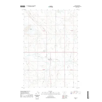
2020 Map of Lavina
USGS Topo · Published 2020About this map
The Musselshell River meanders through the central valley of this Golden Valley County landscape, anchoring the town of Lavina. The settlement is organized around a grid including Main St, 1st Ave, and Railway Ave, reflecting its position as a local hub for transport and agriculture. Irrigation is a defining feature of the local economy, evidenced by the Lavina-Water Users Association Ditch which cuts across the terrain north of the river. To the northwest, the distinctive geological formation of Womans Pocket breaks the prairie landscape near E Red Hill Rd. Community infrastructure is documented through the location of the Lavina Airport and the Lavina Cem, while regional history is hinted at by the route of Buffalo Trl passing through the southern sections. Tributaries like Big Coulee Cr drain the southern hills, contributing to the river system that has shaped this Montana community's development.
Find a feature on this map
27 named features on this map. Tap any name to fly to it.
Don’t see what you’re looking for? This feature index may not catch every label — zoom into the map to look around manually.
Map Details
Editions of this 2020 Lavina Map
This is the sole edition of this map. No revisions or reprints were ever made.
Other maps of this area

1889 · Big Snowy Mountain
USGS Topo · 1:250,000

1893 · Big Snowy Mountain
USGS Topo · 1:250,000

1954 · Roundup
USGS Topo · 1:250,000

1958 · Roundup
USGS Topo · 1:250,000

1979 · Roundup
USGS Topo · 1:100,000

1979 · Bundy
USGS Topo · 1:24,000

1979 · Lavina NW
USGS Topo · 1:24,000

1979 · Timber Buttes South
USGS Topo · 1:24,000

1979 · Lavina
USGS Topo · 1:24,000

1979 · Belmont
USGS Topo · 1:24,000