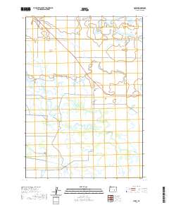
2020 Map of Lawen
USGS Topo · Published 2020About this map
The low-lying wetland landscape of Harney County is defined by the diverging channels of the E Fork Silvies River and W Fork Silvies River. This 2020 survey illustrates a complex hydrologic network where the river system spreads into features like Square Well Slough and Black Slough. The small settlement of Lawen serves as the central hub for the area's rural road network, which includes Crane Blvd and S Harney Rd. Man-made water management is evident through the Ausmus Canal, reflecting the ongoing efforts to direct water across this flat, seasonally inundated basin. The map reveals how local infrastructure, such as Embree Bridge Rd and Lawen Dump Rd, navigates the intricate balance between usable land and the expansive drainage of the Silvies River delta.
Find a feature on this map
24 named features on this map. Tap any name to fly to it.
Don’t see what you’re looking for? This feature index may not catch every label — zoom into the map to look around manually.
Map Details
Editions of this 2020 Lawen Map
This is the sole edition of this map. No revisions or reprints were ever made.
Other maps of this area

1955 · Burns
USGS Topo · 1:250,000

1958 · Burns
USGS Topo · 1:250,000

1959 · Burns
USGS Topo · 1:250,000

1959 · Harney
USGS Topo · 1:62,500

1959 · Lawen
USGS Topo · 1:62,500

1960 · Crane
USGS Topo · 1:62,500

1973 · Carson Point
USGS Topo · 1:24,000

1978 · Malheur Lake
USGS Topo · 1:100,000

1978 · Stinkingwater Mountains
USGS Topo · 1:100,000
1990 · Ninemile Slough
USGS Topo · 1:24,000