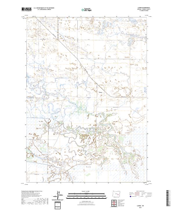
2023 Map of Lawen
USGS Topo · Published 2023About this map
Malheur National Wildlife Refuge anchors the southern portion of this landscape, where the high desert meets a complex network of wetlands and seasonal waterways. The drainage pattern is defined by the diverging paths of the East Fork Silvies River and West Fork Silvies River, which feed into an intricate system of sloughs such as Square Well Slough and Black Slough. This water-rich environment in an otherwise arid region has historically shaped the footprint of local agriculture and habitat management, evidenced by the Ausmus Canal. The small settlement of Lawen serves as a central point for the local road network, which includes descriptively named routes like Embree Bridge Rd and Crane Blvd. These roads trace the section lines of the Public Land Survey System, highlighting the orderly human overlay upon the wandering natural hydrology of the Harney Basin.
Find a feature on this map
24 named features on this map. Tap any name to fly to it.
Don’t see what you’re looking for? This feature index may not catch every label — zoom into the map to look around manually.
Map Details
Editions of this 2023 Lawen Map
This is the sole edition of this map. No revisions or reprints were ever made.
Other maps of this area

1955 · Burns
USGS Topo · 1:250,000

1958 · Burns
USGS Topo · 1:250,000

1959 · Burns
USGS Topo · 1:250,000

1959 · Harney
USGS Topo · 1:62,500

1959 · Lawen
USGS Topo · 1:62,500

1960 · Crane
USGS Topo · 1:62,500

1973 · Carson Point
USGS Topo · 1:24,000

1978 · Malheur Lake
USGS Topo · 1:100,000

1978 · Stinkingwater Mountains
USGS Topo · 1:100,000
1990 · Ninemile Slough
USGS Topo · 1:24,000