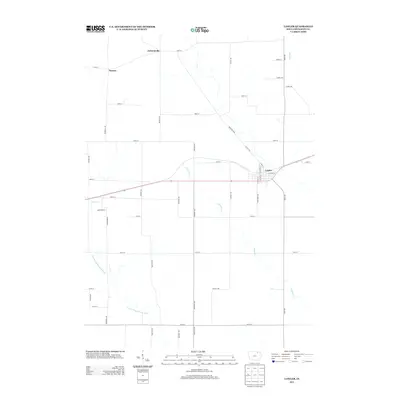
2013 Map of Lawler
USGS Topo · Published 2013About this map
Lawler serves as the primary population center in this part of Chickasaw County, situated amidst a geometric grid of rural roads that define the agricultural landscape. The town's layout is centered near the intersection of N Lincoln St and E Grove St, with several small watercourses like Simpson Cr and Plum Cr draining the surrounding fields. The eastern half of the map is marked by long, straight north-south arteries such as Union Ave and Stanley Ave, while the southwestern quadrant is defined by the meandering course of the E Fork Wapsipinicon River. In the north, the small locales of Jacksonville and Nansen sit at major section intersections, reflecting the traditional township-and-range settlement pattern. This 2013 survey illustrates the persistent importance of the rural road network in maintaining the connectivity of these small farming communities.
Find a feature on this map
38 named features on this map. Tap any name to fly to it.
Don’t see what you’re looking for? This feature index may not catch every label — zoom into the map to look around manually.
Map Details
Editions of this 2013 Lawler Map
This is the sole edition of this map. No revisions or reprints were ever made.
Other maps of this area

1954 · Mason City
USGS Topo · 1:250,000

1954 · Waterloo
USGS Topo · 1:250,000

1955 · Waterloo
USGS Topo · 1:250,000

1957 · Mason City
USGS Topo · 1:250,000

1958 · Mason City
USGS Topo · 1:250,000

1971 · Alpha
USGS Topo · 1:24,000

1971 · Fredericksburg
USGS Topo · 1:24,000

1971 · Frederika
USGS Topo · 1:24,000

1972 · Jerico
USGS Topo · 1:24,000
1972 · New Hampton
USGS Topo · 1:24,000