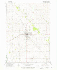
1972 Map of New Hampton
USGS Topo · Published 1976About this map
New Hampton serves as the primary hub of this North Central Iowa landscape, situated at the junction of two major rail lines. The Chicago Milwaukee St Paul and Pacific runs east-west through the center of town, while the Chicago and North Western cuts diagonally across the northern townships of Washington and Jacksonville. This network supported the area's agricultural economy, connecting the small settlements of Devon and Boyd to larger markets.
Find a feature on this map
23 named features on this map. Tap any name to fly to it.
Don’t see what you’re looking for? This feature index may not catch every label — zoom into the map to look around manually.
Map Details
Editions of this 1972 New Hampton Map
This is the sole edition of this map. No revisions or reprints were ever made.
Other maps of this area

1954 · Mason City
USGS Topo · 1:250,000

1954 · Waterloo
USGS Topo · 1:250,000

1955 · Waterloo
USGS Topo · 1:250,000

1957 · Mason City
USGS Topo · 1:250,000

1958 · Mason City
USGS Topo · 1:250,000

1971 · Tripoli NW
USGS Topo · 1:24,000

1971 · Fredericksburg
USGS Topo · 1:24,000

1971 · Frederika
USGS Topo · 1:24,000
1972 · Ionia
USGS Topo · 1:24,000

1972 · Elma
USGS Topo · 1:24,000