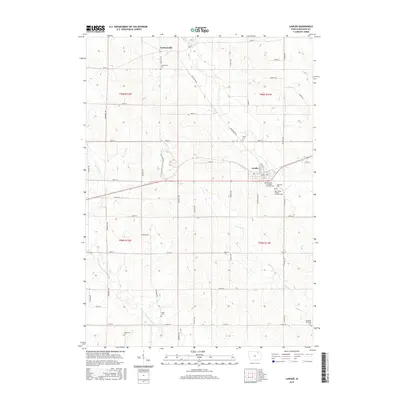
2015 Map of Lawler
USGS Topo · Published 2015About this map
Lawler and Jacksonville anchor this survey of Chickasaw County, revealing a landscape defined by its agricultural heritage and early immigrant roots. The eastern portion of the map is particularly rich in cemetery data, reflecting the local community's religious history through sites like the Our Lady of Mount Carmel Cem, Lutheran Cem, and Saint Johns German Lutheran Cem. These features, clustered near the rail lines and regional roads, provide essential markers for genealogists tracing family names and church lineages in northeast Iowa.
Find a feature on this map
48 named features on this map. Tap any name to fly to it.
Don’t see what you’re looking for? This feature index may not catch every label — zoom into the map to look around manually.
Map Details
Editions of this 2015 Lawler Map
This is the sole edition of this map. No revisions or reprints were ever made.
Other maps of this area

1954 · Mason City
USGS Topo · 1:250,000

1954 · Waterloo
USGS Topo · 1:250,000

1955 · Waterloo
USGS Topo · 1:250,000

1957 · Mason City
USGS Topo · 1:250,000

1958 · Mason City
USGS Topo · 1:250,000

1971 · Alpha
USGS Topo · 1:24,000

1971 · Fredericksburg
USGS Topo · 1:24,000

1971 · Frederika
USGS Topo · 1:24,000

1972 · Jerico
USGS Topo · 1:24,000
1972 · New Hampton
USGS Topo · 1:24,000