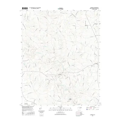
2016 Map of Lawndale
USGS Topo · Published 2016About this map
First Broad River meanders south through the center of this Cleveland County landscape, anchoring a series of small riverside communities and historic family burial grounds. The settlement of Lawndale serves as a central hub, surrounded by smaller locales like Double Shoals, Belwood, and Rockdale. The map reveals a dense network of local roads such as Grady McNeilly Rd and Casar-Lawndale Rd that connect rural homesteads and agricultural tracts. For genealogists, the survey identifies several family-named landmarks and resting places, including Warlick Cem, Eaker Cem, and Mooney Cem. The topography is defined by the winding paths of Knob Cr and Big Harris Cr, which feed into the larger river system, alongside man-made water bodies like Stice Shoal Lake and Shufords Fishing Lake.
Find a feature on this map
132 named features on this map. Tap any name to fly to it.
Don’t see what you’re looking for? This feature index may not catch every label — zoom into the map to look around manually.
Map Details
Editions of this 2016 Lawndale Map
This is the sole edition of this map. No revisions or reprints were ever made.
Other maps of this area

1895 · Hickory
USGS Topo · 1:125,000

1905 · Morganton
USGS Topo · 1:125,000

1909 · Lincolnton
USGS Topo · 1:62,500

1911 · Lincolnton
USGS Topo · 1:62,500

1950 · Shelby
USGS Topo · 1:62,500

1953 · Charlotte
USGS Topo · 1:250,000

1954 · Charlotte
USGS Topo · 1:250,000

1956 · Benn Knob
USGS Topo · 1:24,000

1956 · Casar
USGS Topo · 1:24,000

1960 · Charlotte
USGS Topo · 1:250,000