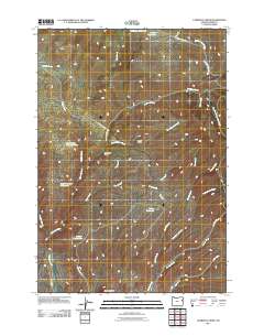
2011 Map of Lawrence Creek
USGS Topo · Published 2011About this map
Iron Mountain anchors the southern boundary of this Baker County landscape, where the high desert terrain is defined by a sophisticated network of water management features. The drainage systems of Lawrence Creek and Durkee Creek are supplemented by several catchment sites, including the Widman Reservoir, Bedsprings Flat Reservoir, and the South Guzzler Waterhole. These features, along with the Taylor Ditch, illustrate the importance of water rights and rangeland management in this part of Oregon. Local names are preserved through landmarks like Olsen Gulch and Hickerson Gulch, while a series of remote roads such as Lawrence Creek Rd and Sardine Creek Rd provide access through the complex network of creeks and draws that feed the region’s larger watersheds.
Find a feature on this map
30 named features on this map. Tap any name to fly to it.
Don’t see what you’re looking for? This feature index may not catch every label — zoom into the map to look around manually.
Map Details
Editions of this 2011 Lawrence Creek Map
This is the sole edition of this map. No revisions or reprints were ever made.
Other maps of this area

1901 · Baker City
USGS Topo · 1:125,000

1915 · Pine
USGS Topo · 1:125,000

1955 · Baker
USGS Topo · 1:250,000

1957 · Sparta
USGS Topo · 1:62,500

1957 · Durkee
USGS Topo · 1:62,500

1959 · Baker
USGS Topo · 1:250,000
1967 · Keating
USGS Topo · 1:24,000

1967 · Lost Basin
USGS Topo · 1:24,000

1981 · Baker
USGS Topo · 1:100,000
1987 · Oxman
USGS Topo · 1:24,000