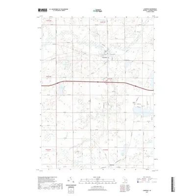
2019 Map of Lawrence
USGS Topo · Published 2019About this map
The Paw Paw River winds through the northern half of this landscape, anchoring the settlement of Lawrence where Red Arrow Hwy meets Bangor Rd. This 2019 survey documents a region defined by its numerous glacial lakes and watercourses, from the large expanse of Christie Lake in the east to Shafer Lake further west. Local history is preserved at sites like the Lawrence Village Cem and the more remote Hill Cem to the northwest. To the south, the smaller community of Fritzburg sits near the intersection of Territorial Rd W and Old Territorial Rd. The map illustrates a developed rural network of county roads and avenues, such as 48th Ave and 72nd Ave, which connect isolated water bodies like Pond Lily Lake and Johnson Lake to the primary transportation corridors.
Find a feature on this map
53 named features on this map. Tap any name to fly to it.
Don’t see what you’re looking for? This feature index may not catch every label — zoom into the map to look around manually.
Map Details
Editions of this 2019 Lawrence Map
This is the sole edition of this map. No revisions or reprints were ever made.
Other maps of this area

1927 · Hartford
USGS Topo · 1:62,500

1927 · Bangor
USGS Topo · 1:62,500

1931 · Bangor
USGS Topo · 1:62,500

1931 · Hartford
USGS Topo · 1:62,500

1943 · Bangor
USGS Topo · 1:62,500

1944 · Marcellus
USGS Topo · 1:62,500

1946 · Marcellus
USGS Topo · 1:62,500

1946 · Gobles
USGS Topo · 1:62,500

1948 · Gobles
USGS Topo · 1:62,500

1949 · Gobles
USGS Topo · 1:62,500