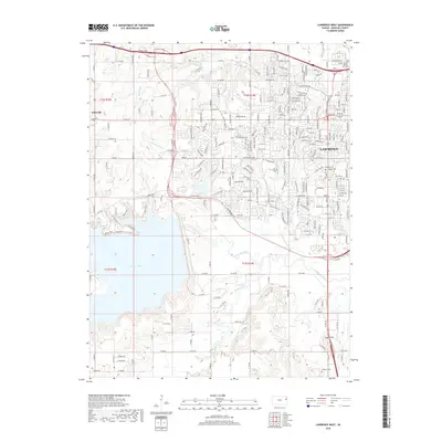
2018 Map of Lawrence West
USGS Topo · Published 2018About this map
Clinton Lake dominates the western landscape of this Douglas County region, where the reservoir's expansive waters meet the winding course of the Wakarusa River. The suburban expansion of Lawrence is evident in the eastern half of the map, showing a dense network of residential streets and major thoroughfares like Bob Billings Pkwy and Clinton Pkwy. In contrast, the northwest corner near Kanwaka retains a more open, rural character defined by the drainage of Baldwin Creek and Yankee Tank Creek.
Find a feature on this map
43 named features on this map. Tap any name to fly to it.
Don’t see what you’re looking for? This feature index may not catch every label — zoom into the map to look around manually.
Map Details
Editions of this 2018 Lawrence West Map
This is the sole edition of this map. No revisions or reprints were ever made.
Other maps of this area

1885 · Lawrence
USGS Topo · 1:125,000

1886 · Oskaloosa
USGS Topo · 1:125,000

1888 · Oskaloosa
USGS Topo · 1:125,000

1889 · Lawrence
USGS Topo · 1:125,000

1894 · Oskaloosa
USGS Topo · 1:125,000

1947 · Lawrence
USGS Topo · 1:250,000

1949 · Williamstown
USGS Topo · 1:24,000

1949 · Perry
USGS Topo · 1:24,000

1950 · Perry
USGS Topo · 1:24,000

1950 · Kansas City
USGS Topo · 1:250,000