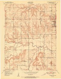
1951 Map of Lawrence West
USGS Topo · Published 1951About this map
The University of Kansas dominates the eastern edge of this landscape, overlooking the westward-flowing Wakarusa River. This mid-century survey captures the rural character of Douglas County before modern expansion, where the townships of Kanwaka and Wakarusa are dotted with a high density of one-room schoolhouses. Notable educational sites include Sigel Sch, Kanwaka Sch, and Washington Creek Sch, indicating the distributed nature of the community's early social life.
Find a feature on this map
25 named features on this map. Tap any name to fly to it.
Don’t see what you’re looking for? This feature index may not catch every label — zoom into the map to look around manually.
Map Details
Editions of this 1951 Lawrence West Map
This is the sole edition of this map. No revisions or reprints were ever made.
Other maps of this area

1885 · Lawrence
USGS Topo · 1:125,000

1886 · Oskaloosa
USGS Topo · 1:125,000

1888 · Oskaloosa
USGS Topo · 1:125,000

1889 · Lawrence
USGS Topo · 1:125,000

1894 · Oskaloosa
USGS Topo · 1:125,000

1947 · Lawrence
USGS Topo · 1:250,000

1949 · Williamstown
USGS Topo · 1:24,000

1949 · Perry
USGS Topo · 1:24,000

1950 · Perry
USGS Topo · 1:24,000

1950 · Kansas City
USGS Topo · 1:250,000