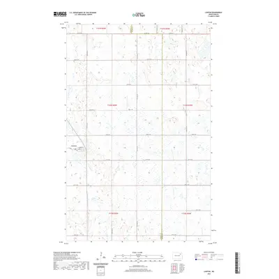
2020 Map of Lawton
USGS Topo · Published 2020About this map
Lawton serves as the primary focal point of this North Dakota prairie landscape, situated in the western portion of the quadrangle. The town's small-scale grid is clearly defined by Main St and Chapman St, reflecting its historical development as a rural service center. This 2020 record illustrates the enduring Public Land Survey System structure, with a dense network of sectional roads such as 66th St NE and 105th Ave NE that partition the agricultural land. The terrain is characterized by a significant number of wetlands and small water bodies dispersed throughout the townships, including t157n r60w and t156n r59w. The transition from Ramsey Co to Walsh Co is marked in the northeastern sector, where Co Rd 22A and the Prairie Trl traverse the landscape.
Find a feature on this map
27 named features on this map. Tap any name to fly to it.
Don’t see what you’re looking for? This feature index may not catch every label — zoom into the map to look around manually.
Map Details
Editions of this 2020 Lawton Map
This is the sole edition of this map. No revisions or reprints were ever made.
Other maps of this area

1953 · Devils Lake
USGS Topo · 1:250,000

1956 · Devils Lake
USGS Topo · 1:250,000

1971 · Brocket
USGS Topo · 1:24,000

1971 · Pelto
USGS Topo · 1:24,000

1971 · Lakota NW
USGS Topo · 1:24,000

1972 · Edmore SW
USGS Topo · 1:24,000

1972 · Edmore
USGS Topo · 1:24,000

1972 · Adams SW
USGS Topo · 1:24,000

1972 · Fairdale
USGS Topo · 1:24,000

1972 · Edmore NE
USGS Topo · 1:24,000