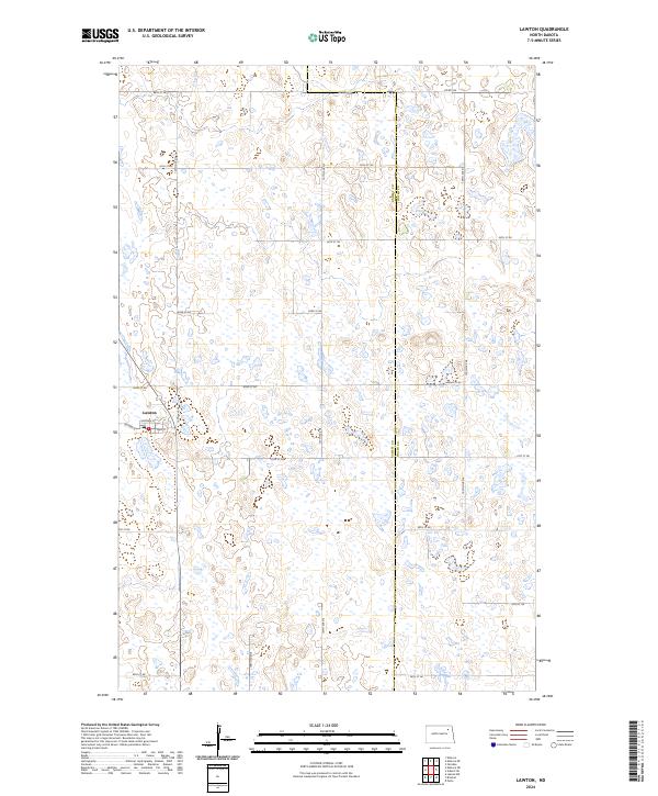
2024 Map of Lawton
USGS Topo · Published 2024About this map
Lawton serves as the primary settlement on this prairie landscape, situated at the intersection of Co Hwy 8 and Main St. The town's grid is small but distinct, featuring local routes like Chapman St. To the northwest, the Ramsey County Waterfowl Production Area indicates a terrain dominated by numerous small wetlands and prairie potholes, which are characteristic of this region. The map also delineates the boundary between Ramsey and Walsh Counties. A dense network of section-line roads, such as 66th St NE and 60th St NE, creates a regular lattice across the townships, reflecting the systematic land survey and agricultural organization of the North Dakota plains. The abundance of water bodies interspersed with these roads highlights the seasonal nature of the local hydrography.
Find a feature on this map
23 named features on this map. Tap any name to fly to it.
Don’t see what you’re looking for? This feature index may not catch every label — zoom into the map to look around manually.
Map Details
Editions of this 2024 Lawton Map
This is the sole edition of this map. No revisions or reprints were ever made.
Other maps of this area

1953 · Devils Lake
USGS Topo · 1:250,000

1956 · Devils Lake
USGS Topo · 1:250,000

1971 · Brocket
USGS Topo · 1:24,000

1971 · Pelto
USGS Topo · 1:24,000

1971 · Lakota NW
USGS Topo · 1:24,000

1972 · Edmore SW
USGS Topo · 1:24,000

1972 · Edmore
USGS Topo · 1:24,000

1972 · Adams SW
USGS Topo · 1:24,000

1972 · Fairdale
USGS Topo · 1:24,000

1972 · Edmore NE
USGS Topo · 1:24,000