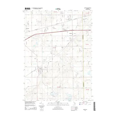
2014 Map of Lawton
USGS Topo · Published 2014About this map
The E Br Paw Paw River meanders through this portion of Van Buren County, anchoring a landscape defined by its glacial lakes and the early 21st-century growth of Lawton, Mattawan, and the eastern edge of Paw Paw. The map documents a transition from the agricultural grid to suburban expansion, notably around the Mattawan Airpark. Genealogists will find a high density of small burial grounds scattered across the townships, including Oak Grove Cem, Maple Grove Cem, and Chamberlin Cem. Water management is prominent through features like the Lawton Drain and Gates Extension Drain, which navigate the low-lying terrain between larger bodies of water such as Bankson Lake, Cedar Lake, and Huzzy Lake. The proximity of the Van Buren Co Kalamazoo Co border highlights the regional connection between these village centers and the broader transportation corridor along Red Arrow Hwy.
Find a feature on this map
82 named features on this map. Tap any name to fly to it.
Don’t see what you’re looking for? This feature index may not catch every label — zoom into the map to look around manually.
Map Details
Editions of this 2014 Lawton Map
This is the sole edition of this map. No revisions or reprints were ever made.
Other maps of this area

1916 · Kalamazoo
USGS Topo · 1:62,500

1918 · Kalamazoo
USGS Topo · 1:62,500

1922 · Schoolcraft
USGS Topo · 1:62,500

1943 · Kalamazoo
USGS Topo · 1:62,500

1943 · Schoolcraft
USGS Topo · 1:62,500

1944 · Marcellus
USGS Topo · 1:62,500

1946 · Marcellus
USGS Topo · 1:62,500

1946 · Gobles
USGS Topo · 1:62,500

1948 · Gobles
USGS Topo · 1:62,500

1949 · Gobles
USGS Topo · 1:62,500