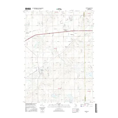
2017 Map of Lawton
USGS Topo · Published 2017About this map
Lawton and Mattawan anchor this section of Van Buren County, illustrating the agricultural and residential landscape of southwest Michigan in the 21st century. The map reveals a dense network of country burial grounds, such as Oak Grove Cem and Harwick Cem, which provide significant anchor points for local genealogical research. The terrain is defined by a glacial topography of kettle lakes and wetlands, featuring prominent water bodies like Bankson Lake, Huzzy Lake, and the winding E Br Paw Paw River. The influence of transportation on the region's development is evident in the corridors of the Co RD 364 rail line and the presence of Mattawan Airpark. Between the villages, the land is etched with drainage systems like the Lawton Drain and Gates Extension Drain, supporting the vineyards and orchards characteristic of this fruit-growing belt.
Find a feature on this map
148 named features on this map. Tap any name to fly to it.
Don’t see what you’re looking for? This feature index may not catch every label — zoom into the map to look around manually.
Map Details
Editions of this 2017 Lawton Map
This is the sole edition of this map. No revisions or reprints were ever made.
Other maps of this area

1916 · Kalamazoo
USGS Topo · 1:62,500

1918 · Kalamazoo
USGS Topo · 1:62,500

1922 · Schoolcraft
USGS Topo · 1:62,500

1943 · Kalamazoo
USGS Topo · 1:62,500

1943 · Schoolcraft
USGS Topo · 1:62,500

1944 · Marcellus
USGS Topo · 1:62,500

1946 · Marcellus
USGS Topo · 1:62,500

1946 · Gobles
USGS Topo · 1:62,500

1948 · Gobles
USGS Topo · 1:62,500

1949 · Gobles
USGS Topo · 1:62,500