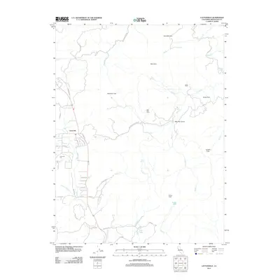
2012 Map of Laytonville
USGS Topo · Published 2012About this map
Laytonville serves as the central hub of this Northern California landscape, where the valley floor meets the rising peaks of the Coast Ranges. The settlement is defined by its connection to the surrounding backcountry via routes like Laytonville Dos Rios Rd and Woodman Peak Rd. To the west of the town center, Laytonville Cem provides a key reference point for local history and genealogy.
Find a feature on this map
46 named features on this map. Tap any name to fly to it.
Don’t see what you’re looking for? This feature index may not catch every label — zoom into the map to look around manually.
Map Details
Editions of this 2012 Laytonville Map
This is the sole edition of this map. No revisions or reprints were ever made.
Other maps of this area

1920 · Cummings
USGS Topo · 1:62,500

1920 · Covelo
USGS Topo · 1:62,500

1921 · Branscomb
USGS Topo · 1:62,500

1951 · Branscomb
USGS Topo · 1:62,500

1951 · Laytonville
USGS Topo · 1:62,500

1952 · Spyrock
USGS Topo · 1:62,500

1952 · Leggett
USGS Topo · 1:62,500

1957 · Ukiah
USGS Topo · 1:250,000

1960 · Ukiah
USGS Topo · 1:250,000
1966 · Longvale
USGS Topo · 1:24,000