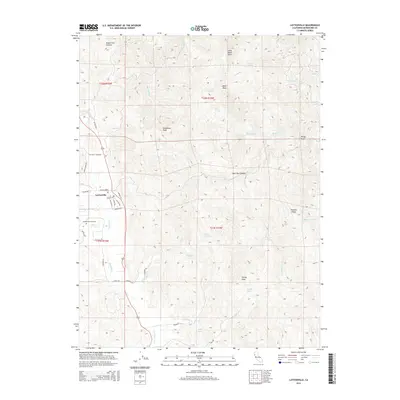
2015 Map of Laytonville
USGS Topo · Published 2015About this map
Laytonville serves as the central hub for this portion of Mendocino County, where the valley floor meets the rising peaks of the coastal range. The settlement's layout is defined by a network of local roads including Branscomb Rd and Harwood Rd, with the Laytonville Cemetery situated just to the west. The surrounding landscape is a complex system of ridges and canyons, marked by significant elevations like Woodman Peak and Farley Peak. Water resources are abundant throughout these heights, ranging from the named flows of Tenmile Creek and Long Valley Cr to high-elevation features like Farley Lake and Vinton Lake. Genealogical interest is found in family-named landmarks such as Holmen Ridge and Brad Turner Cr, while unique natural features like Little Black Rock and One Eyed Cr characterize the rugged northern drainage basins.
Find a feature on this map
48 named features on this map. Tap any name to fly to it.
Don’t see what you’re looking for? This feature index may not catch every label — zoom into the map to look around manually.
Map Details
Editions of this 2015 Laytonville Map
This is the sole edition of this map. No revisions or reprints were ever made.
Other maps of this area

1920 · Cummings
USGS Topo · 1:62,500

1920 · Covelo
USGS Topo · 1:62,500

1921 · Branscomb
USGS Topo · 1:62,500

1951 · Branscomb
USGS Topo · 1:62,500

1951 · Laytonville
USGS Topo · 1:62,500

1952 · Spyrock
USGS Topo · 1:62,500

1952 · Leggett
USGS Topo · 1:62,500

1957 · Ukiah
USGS Topo · 1:250,000

1960 · Ukiah
USGS Topo · 1:250,000
1966 · Longvale
USGS Topo · 1:24,000