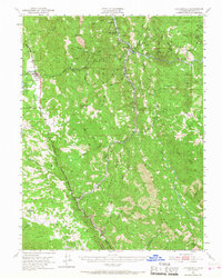
1951 Map of Laytonville
USGS Topo · Published 1968About this map
Laytonville and the tribal lands of the Laytonville Rancheria and Sherwood Rancheria anchor this mid-century survey of the Mendocino highlands. The landscape is defined by the steep corridors of Outlet Creek and the Eel River, where the Northwestern Pacific railroad snakes through narrow canyons to reach remote outposts like Dos Rios and Tatu. High-altitude features such as Farley Peak and Mendocino Ridge overlook a network of seasonal watercourses and ridges, including Shimmin Ridge and Willits Ridge.
Find a feature on this map
50 named features on this map. Tap any name to fly to it.
Don’t see what you’re looking for? This feature index may not catch every label — zoom into the map to look around manually.
Map Details
Editions of this 1951 Laytonville Map
5 editions found

Other maps of this area

1920 · Glenblair
USGS Topo · 1:62,500

1920 · Cummings
USGS Topo · 1:62,500

1920 · Covelo
USGS Topo · 1:62,500

1921 · Branscomb
USGS Topo · 1:62,500

1922 · Willits
USGS Topo · 1:62,500

1926 · Covelo
USGS Topo · 1:62,500

1929 · Eden Valley
USGS Topo · 1:62,500

1942 · Willits
USGS Topo · 1:62,500

1943 · Glenblair
USGS Topo · 1:62,500

1943 · Pomo
USGS Topo · 1:62,500