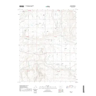
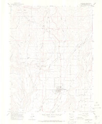
2019 Map of Lazear
USGS Topo · Published 2019About this map
The North Fork Gunnison River carves a deep path through Delta County, defining the agricultural and aviation landscape of this western Colorado region. The settlement of Lazear sits at the base of Rogers Mesa, a prominent plateau heavily developed for local irrigation and transportation. The network of water management features, such as the Fire Mountain Canal, Oasis Ditch, and Highline Ditch, indicates the area's intensive agricultural use. This survey illustrates a unique concentration of private aviation, showing multiple landing strips including Eden Ranch Airport, Redlands Airport, and Omega 1 Airport scattered across the high mesas. To the south, the terrain drops dramatically into the Black Canyon of the Gunnison, while northern features like Cedar Mesa and Redlands Mesa provide a clear view of the bench-and-valley topography characteristic of the Gunnison River basin.
Find a feature on this map
89 named features on this map. Tap any name to fly to it.
Don’t see what you’re looking for? This feature index may not catch every label — zoom into the map to look around manually.
Map Details
Editions of this 2019 Lazear Map
This is the sole edition of this map. No revisions or reprints were ever made.
Other maps of this area

1955 · Olathe NW
USGS Topo · 1:24,000

1955 · Black Ridge
USGS Topo · 1:24,000

1955 · Lazear
USGS Topo · 1:24,000

1956 · Montrose
USGS Topo · 1:250,000

1959 · Montrose
USGS Topo · 1:250,000

1960 · Montrose
USGS Topo · 1:250,000
1962 · Orchard City
USGS Topo · 1:24,000
1965 · Gray Reservoir
USGS Topo · 1:24,000
1965 · Dry Creek
USGS Topo · 1:24,000
1965 · Cedaredge
USGS Topo · 1:24,000