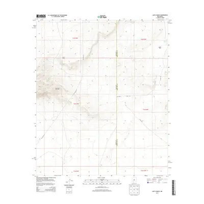
2013 Map of Lazy E Ranch
USGS Topo · Published 2013About this map
The Good Sight Mountains dominate the western landscape of this high-desert region, overlooking the expansive Uvas Valley and the broad eastern reach of Apache Flats. As a modern topographic study, it documents the sparse ranching and utility infrastructure that sustains life in this arid basin. The namesake Lazy E Ranch is a primary landmark in a territory where water sources like Apache Tank are critical markers for land use. Utility corridors, such as the prominent Gas Pipeline Rd, cut through the terrain alongside county routes like Co Road C001, illustrating the large-scale energy and transport networks that traverse the borderlands. This survey also records the administrative division between the Luna and Doña Ana County lines, providing a detailed look at property and political boundaries in the early 21st century.
Find a feature on this map
14 named features on this map. Tap any name to fly to it.
Don’t see what you’re looking for? This feature index may not catch every label — zoom into the map to look around manually.
Map Details
Editions of this 2013 Lazy E Ranch Map
This is the sole edition of this map. No revisions or reprints were ever made.
Other maps of this area

1941 · Aden
USGS Topo · 1:62,500

1943 · Aden
USGS Topo · 1:62,500

1943 · Corralitos Ranch
USGS Topo · 1:62,500

1955 · Las Cruces
USGS Topo · 1:250,000

1958 · Las Cruces
USGS Topo · 1:250,000

1972 · Myndus
USGS Topo · 1:24,000

1972 · Cambray
USGS Topo · 1:24,000

1972 · Good Sight Peak NE
USGS Topo · 1:24,000

1972 · Good Sight Peak
USGS Topo · 1:24,000

1972 · Lazy E Ranch
USGS Topo · 1:24,000