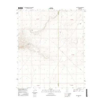
2017 Map of Lazy E Ranch
USGS Topo · Published 2017About this map
Good Sight Mountains dominate the western landscape of this high desert region along the border of Luna and Doña Ana counties. The terrain transitions from these peaks into the Uvas Valley and across the broad expanse of Apache Flats to the east. This 2017 survey captures a specialized ranching environment where water management is critical, evidenced by the presence of Apache Tank and the namesake Lazy E Ranch. The area is navigated primarily via Co RD c001, which serves as the principal artery for local travel through the Chihuahuan Desert brush. The map provides a clear look at the Public Land Survey System grid, including townships like t23s r4w, which define the administrative and ownership history of this rural New Mexico territory.
Find a feature on this map
13 named features on this map. Tap any name to fly to it.
Don’t see what you’re looking for? This feature index may not catch every label — zoom into the map to look around manually.
Map Details
Editions of this 2017 Lazy E Ranch Map
This is the sole edition of this map. No revisions or reprints were ever made.
Other maps of this area

1941 · Aden
USGS Topo · 1:62,500

1943 · Aden
USGS Topo · 1:62,500

1943 · Corralitos Ranch
USGS Topo · 1:62,500

1955 · Las Cruces
USGS Topo · 1:250,000

1958 · Las Cruces
USGS Topo · 1:250,000

1972 · Myndus
USGS Topo · 1:24,000

1972 · Cambray
USGS Topo · 1:24,000

1972 · Good Sight Peak NE
USGS Topo · 1:24,000

1972 · Good Sight Peak
USGS Topo · 1:24,000

1972 · Lazy E Ranch
USGS Topo · 1:24,000