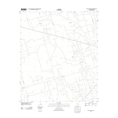
2012 Map of Lazy X Ranch
USGS Topo · Published 2012About this map
Lazy X Ranch and its surrounding acreage reveal a landscape defined by industrial energy extraction in Andrews County. The intricate network of local access roads, including Block Road 12 and Miles Rd, serves an extensive complex of petroleum interests. Large-scale operations such as the Shafter Lake Oil Field and Shafter Lake Gas Field dominate the northern portion of the quadrangle, while the Mascho Oil Field and Deep Rock Oil Field extend across the central and southern reaches.
Find a feature on this map
20 named features on this map. Tap any name to fly to it.
Don’t see what you’re looking for? This feature index may not catch every label — zoom into the map to look around manually.
Map Details
Editions of this 2012 Lazy X Ranch Map
This is the sole edition of this map. No revisions or reprints were ever made.
Other maps of this area

1954 · Hobbs
USGS Topo · 1:250,000

1958 · Hobbs
USGS Topo · 1:250,000

1963 · Andrews
USGS Topo · 1:24,000

1968 · North Cowden NW
USGS Topo · 1:24,000

1968 · Clabber Hill Ranch
USGS Topo · 1:24,000

1971 · Florey
USGS Topo · 1:24,000

1971 · Frankel City
USGS Topo · 1:24,000

1971 · Whalen Lake
USGS Topo · 1:24,000

1971 · Sand Ranch
USGS Topo · 1:24,000

1971 · Shafter Lake
USGS Topo · 1:24,000