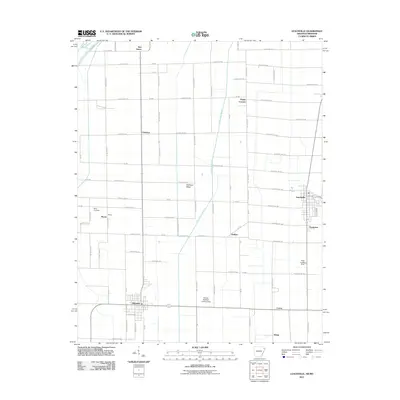
2011 Map of Leachville
USGS Topo · Published 2011About this map
The town of Leachville sits at the eastern edge of this agricultural landscape in Mississippi County, Arkansas, where the drainage network of Kinnemore Slough cuts through a grid of rural county roads. Just south of the Missouri state line, the area is defined by its small farming communities and historic crossroad settlements like Childress, Delfore, and Macey. The terrain is predominantly level, reflecting the alluvial character of the Delta, with linear features such as Old Town Ridge providing subtle elevation. Local aviation is represented by small private facilities including Whited Brothers Landing Strip and the Price Landing-Strip, while the southern portion of the map includes the residential and street grid of Monette. Genealogy researchers will find the Macy Cemetery located near the western border, and various family-named junctions such as Happy Corners and Red Onion help identify the social and commercial hubs of this rural region.
Find a feature on this map
57 named features on this map. Tap any name to fly to it.
Don’t see what you’re looking for? This feature index may not catch every label — zoom into the map to look around manually.
Map Details
Editions of this 2011 Leachville Map
This is the sole edition of this map. No revisions or reprints were ever made.
Other maps of this area

1934 · Kennett
USGS Topo · 1:62,500

1940 · Marmaduke
USGS Topo · 1:62,500

1940 · Kennett
USGS Topo · 1:62,500

1941 · Leachville
USGS Topo · 1:62,500

1941 · Manila
USGS Topo · 1:62,500

1953 · Memphis
USGS Topo · 1:250,000

1956 · Leachville
USGS Topo · 1:62,500

1956 · Kennett
USGS Topo · 1:62,500

1956 · Manila
USGS Topo · 1:62,500

1956 · Memphis
USGS Topo · 1:250,000