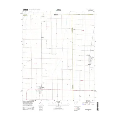
2014 Map of Leachville
USGS Topo · Published 2014About this map
Kinnemore Slough cuts through the drainage-dictated geography of this border region, where the flatlands of the Mississippi embayment are carved into a geometric grid of county roads and section lines. The settlement of Leachville serves as a primary hub near the eastern edge, while Monette anchors the southwestern corner. These communities are linked by a network of rural routes such as Ar-139 N and Ar-18, which connect smaller locales including Childress, Old Town Ridge, and the cross-border community of Red Onion along the State Line Rd.
Find a feature on this map
95 named features on this map. Tap any name to fly to it.
Don’t see what you’re looking for? This feature index may not catch every label — zoom into the map to look around manually.
Map Details
Editions of this 2014 Leachville Map
This is the sole edition of this map. No revisions or reprints were ever made.
Other maps of this area

1934 · Kennett
USGS Topo · 1:62,500

1940 · Marmaduke
USGS Topo · 1:62,500

1940 · Kennett
USGS Topo · 1:62,500

1941 · Leachville
USGS Topo · 1:62,500

1941 · Manila
USGS Topo · 1:62,500

1953 · Memphis
USGS Topo · 1:250,000

1956 · Leachville
USGS Topo · 1:62,500

1956 · Kennett
USGS Topo · 1:62,500

1956 · Manila
USGS Topo · 1:62,500

1956 · Memphis
USGS Topo · 1:250,000