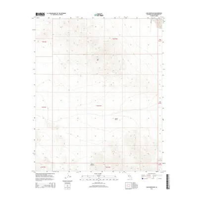
2015 Map of Lead Mountain
USGS Topo · Published 2015About this map
Lead Mtn rises as a central landmark in this desolate corner of the Mojave Desert within San Bernardino County. The landscape is dominated by the stark topography of the Bullion Mountains to the south, where the elevation changes are documented by the United States Geological Survey. This 2015 data illustrates a region defined by its isolation and lack of permanent settlement, with only the remote path of Bagdad Way cutting through the northern reaches of the quadrangle. The map captures the vast township and range divisions, such as t5n r10e, which organize this arid expanse. For researchers, the sheet provides an exact record of natural desert features and terrain before any modern desert development or conservation shifts might alter the accessibility of these remote peaks.
Find a feature on this map
13 named features on this map. Tap any name to fly to it.
Don’t see what you’re looking for? This feature index may not catch every label — zoom into the map to look around manually.
Map Details
Editions of this 2015 Lead Mountain Map
This is the sole edition of this map. No revisions or reprints were ever made.
Other maps of this area

1942 · Amboy
USGS Topo · 1:250,000

1943 · Amboy
USGS Topo · 1:250,000

1953 · San Bernardino
USGS Topo · 1:250,000

1954 · Needles
USGS Topo · 1:250,000

1954 · Amboy Crater
USGS Topo · 1:24,000

1954 · Bagdad SW
USGS Topo · 1:24,000

1954 · Ludlow SE
USGS Topo · 1:24,000

1955 · Lead Mountain
USGS Topo · 1:24,000

1955 · Deadman Lake SE
USGS Topo · 1:24,000

1955 · Lead Mtn. NE
USGS Topo · 1:24,000